Railroad right-of-way, west of Sierra Blanca
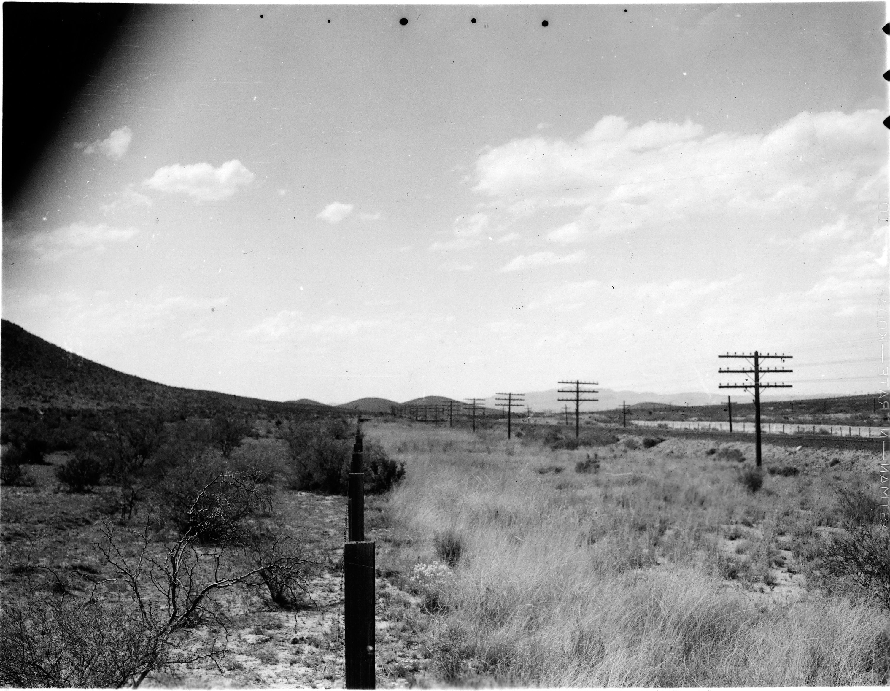
Railroad right-of-way, 5 miles west of Sierra Blanca, where the plant soil correlation study station number 4 was located. The grassland to the right of the picture has been under fence for 30 years while the browse to the left of the picture has been open to livestock grazing. The vegetation inside the fence is composed of 20 percent Bouteloua gracilis, 15 percent Sporobolus airoides, 10 percent Hilaria mutica, 10 percent Andropogon hallii, 5 percent Serghum halepense, 5 percent Panicum obtusus and 8 percent Atriplex canescens. The average density is .65 and the forage acre factor is .27. Erosion is very slight and some deposition is apparent under vegetative cover. The vegetation outside the fence consists of 35 percent Sporobolus airoides, 20 percent Bouteloua gracilis, 10 percent Triodia pulchella, 5 percent Bouteloua eriopoda, 10 percent Flourensia ceruna and 5 percent Prosopis glandulosa. The average density is .30 and the forage acre factor is .12. Erosion is both moderate sheet and wind erosion with occasional gullies. The soil is a heavy type with a deep profile and a well developed, non-cemented lime zone. This area gives an excelent example of the change from grassland to browse cover caused by overgrazing. Original photo number 303.